Garmin Montana 610 Reviews

Main advantage:
The most remarkable thing about this GPS is its large 4″ touch screen with high resolution, which allows reading and handling without problems, even if you are in the sun, so you can take it with you on all your adventures.
Main disadvantage:
This handheld device is heavier than others on the market, but due to its characteristics, it is considered one of the best purchase options and is one of the most recommended by users.
Verdict: 9.7/10
It is a mountain GPS with which you can feel safe on and off the road, thanks to its extensive satellite support, waterproofing and autonomy.
Main Features Explained
Design
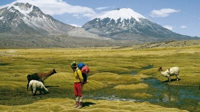
When it comes to enjoying outdoor sports activities, it is useful to have a GPS that you can take everywhere, as is the case with this Montana 610 model, which has been designed for adventurers.
One of the most notable features of this product is its large 4″ touch screen with a resolution of 272 x 480 pixels, for easy and legible reading with high clarity, even under the sun. You can use it in the most convenient position, either horizontal or vertical, in the car, motorcycle or bicycle, as well as take it with you while hiking or just walking and enjoying nature.
This device is resistant to dust and water so mud or rain will not be a concern, as it withstands dirt and various weather conditions. In addition, its dimensions of 7.48 x 14.42 x 3.64 cm (width / height / depth) facilitate its maneuverability and can be inserted into a pocket.

Satellite coverage and autonomy
The Garmin brand has extensive experience in creating navigation products for various activities. For this reason, it offers a very complete selection of the best mountain GPS to satisfy the most demanding users.
In this sense, this device has a highly sensitive receiver for signals from two geopositioning systems, GPS and GLONASS, with which you can know your position faster and with greater precision. Hence, by having a greater number of satellites, you will have greater support even in wooded areas.
It also provides a free 1-year subscription to BirdsEye satellite imagery, so you can transfer unlimited high-resolution aerial imagery and layer Garmin vector maps on your handheld device. This, together with the free BaseCamp software, will allow you to visualize in real time any route, terrain and road, as well as buildings so that you can plan your route in advance and be able to know the different alternatives in your excursion, walk or adventure without getting lost.
On the other hand, this equipment has a rechargeable lithium-ion battery to provide up to 16 hours of use. However, if you do not have the possibility of recharging it in time, using 3 standard AA batteries you can extend its autonomy for up to 22 hours.
smart apps
In the market you will find different mountain GPS at a good price and with positive user opinions, but the Garmin Montana 610 represents a very practical and versatile option so that you feel safe on and off the road.
Thus, it has more than 250,000 preloaded geocaches, being able to save and consult relevant data at any time such as terrain, difficulty, among others, since now paperwork and manual searches are unnecessary. Also, if you want to add other caches you just have to load the GPX file.
On the other hand, this handheld device has useful features for outdoor activities, such as a three-axis electronic compass, which will indicate where you are going regardless of the level. Also, a barometric altimeter so that you are aware of any change in atmospheric pressure and altitude, and at the same time, know the unevenness that you are overcoming in the sports or adventure day.
Another application that favors users is Track Manager, with which you can easily record the route you’re taking to consult it or share it with others later. You can also customize the home screen of your Montana 610, modify settings or create shortcuts, so you have what you need without wasting time.
Plus, for added enjoyment, this GPS lets you share items like your trag log, photos, and geocaches with your colleagues, friends, and the Garmin community through Garmin Adventures, so they don’t miss a thing and stay connected to the adventure.